dhis2-users team mailing list archive
-
 dhis2-users team
-
Mailing list archive
-
Message #12823
Re: Disease surveillance on DHIS2
-
To:
Prosper BT <ptb3000@xxxxxxxxx>
-
From:
GROUT, Lise <groutl@xxxxxxx>
-
Date:
Wed, 15 Mar 2017 07:00:13 +0000
-
Accept-language:
en-US
-
Authentication-results:
gmail.com; dkim=none (message not signed) header.d=none; gmail.com; dmarc=none action=none header.from=who.int;
-
Cc:
GARNICA CAPARROS, Marc <garnicacaparrosm@xxxxxxx>, dhis1-users <dhis2-users@xxxxxxxxxxxxxxxxxxx>, RUIZ POSTIGO, Jose Antonio <postigoj@xxxxxxx>, oromero@xxxxxxxxxxxx <oromero@xxxxxxxxxxxx>, ALBAJAR VINAS, Pedro <albajarvinasp@xxxxxxx>, ABELLO Alberto (aabello@xxxxxxxxxxxx) <aabello@xxxxxxxxxxxx>, Petar Jovanovic <petar@xxxxxxxxxxxx>, knutst@xxxxxxxxxx <knutst@xxxxxxxxxx>
-
In-reply-to:
<CAE0mfvy12tM24nG510qV4=yC32h8i6Ww2mi9hgQR7OMX_jrQ5g@mail.gmail.com>
-
Spamdiagnosticmetadata:
NSPM
-
Spamdiagnosticoutput:
1:99
-
Thread-index:
AQHSnUikmOzPwZF530CtA2eJHcK5GqGVd7MA
-
Thread-topic:
[Dhis2-users] Disease surveillance on DHIS2
Dear Prosper,
Thank you very much for your email.
We considered the option of having an Attribute of DE coordinates (and we actually have it as plan B to capture place of residence/infection in case the village is not found in the org unit tree).
But if coordinates enable to map at village level, which is one of our requirements, it does not allow for aggregation along the org unit tree based on place of residence. The coordinates DE is only available in GIS App, not in pivot table App. This DE does therefore not help in calculating an accurate incidence and population at risk, which is a very important requirement for us (and I imagine for most of the people working on disease surveillance) as the cases still aggregate on place of treatment (registering org unit) and not place of residence/infection.
We will have a look at the jiras.
I hope there will be soon some sessions on disease surveillance in DHIS2 to be able to share experience and use cases.
Best regards,
Lise
From: Prosper BT [mailto:ptb3000@xxxxxxxxx]
Sent: 15 March 2017 05:56
To: GROUT, Lise
Cc: dhis1-users; Abyot Asalefew Gizaw; lars@xxxxxxxxx; knutst@xxxxxxxxxx; Knut Staring; GARNICA CAPARROS, Marc; Petar Jovanovic; RUIZ POSTIGO, Jose Antonio; oromero@xxxxxxxxxxxx; ABELLO Alberto (aabello@xxxxxxxxxxxx); ALBAJAR VINAS, Pedro
Subject: Re: [Dhis2-users] Disease surveillance on DHIS2
Dear Lise,
Thanks for sharing these nice additions to the IDSR global requirements, we can schedule a skype call and talk more about some of the challenges raised, but a number of them are already in jira on the roadmap.
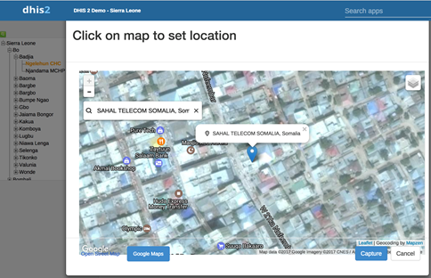
Quickly on GIS presentation and Geo coordinates of the cases from your objectives its clear you want to map cases and the appropriate option would be to get DE or attribute coordinates of each case not the Orgunit DE.
The coordinate DE will enable you achieve your objective this is what we suggesting for the global case notification, yes not all villages are not in google maps but atleast a nearby or zooming in google earth and locating the familiar structures in the village would serve the purpose. But this is if internet is not a challenge.
[Inline image 1]
Regards
Prosper Behumbiize, MPH
DHIS2 Implementation| HISP Uganda
prosper@xxxxxxxxxxxxxx | prosper@xxxxxxxxx | Skype: prospertb
On Tue, Mar 14, 2017 at 1:54 AM, GROUT, Lise <groutl@xxxxxxx> wrote:
Dear DHIS22 team and users,
We have been working on customizing DHIS2 for NTDs surveillance. Please find attached a first draft describing what we have done in DHIS2 to capture and analyze the place of residence/infection and enable the accurate calculation of incidence and population at risk.
We will be happy to have your feedback on this and to read other experience on using DHIS2 for disease surveillance.
Best regards,
Lise.
Dr. Lise Grout
Epidemiologist
World Health Organization
Department of Neglected Tropical Diseases (HTM/NTD/IDM)
Innovative and Intensified Disease Management Unit
20, Avenue Appia; CH-1211 Geneva 27
Tel. +41 22 791 2341
Mobile +41 79 290 68 61
Skype: tigrouveto
http://www.who.int/neglected_diseases
_______________________________________________
Mailing list: https://launchpad.net/~dhis2-users
Post to : dhis2-users@xxxxxxxxxxxxxxxxxxx
Unsubscribe : https://launchpad.net/~dhis2-users
More help : https://help.launchpad.net/ListHelp
References